
🗺️ Boating GPS Units & Chartplotters
Enhance Your Boating Experience with High-Precision GPS Units and Accessories
Embarking on a boating adventure is a thrilling experience, but navigating through vast bodies of water can be challenging. That's where boating GPS finders and accessories for marine electronics come to the rescue. With their advanced features and high-precision capabilities, these cutting-edge tools are essential for any boating enthusiast, providing accurate navigation and peace of mind on the open seas.
Discover the Perfect GPS Chartplotter for Small Boat Navigation
When it comes to small boat navigation, having a reliable and compact GPS chartplotter is paramount. These nifty devices combine GPS technology with advanced chartplotting capabilities, allowing you to pinpoint your location and plot routes with ease. Whether you're exploring tranquil lakes, winding rivers, or venturing offshore, a GPS chartplotter tailored for small boat navigation ensures you stay on course and reach your destination safely.
Stay Ahead of the Game with a Waterproof Marine GPS
When unpredictable weather and rough waters are part of your boating adventures, a waterproof marine GPS is your trusty companion. Designed to withstand the elements, these rugged devices offer advanced chartplotting features in a waterproof casing, ensuring they remain fully functional even in challenging conditions. No matter how intense the rain or how turbulent the waves, you can rely on your waterproof marine GPS to provide accurate navigation and keep you on track.
Experience Advanced Chartplotting with a Waterproof Marine GPS
Not all marine GPS units are created equal. For those seeking top-notch features and unparalleled accuracy, a waterproof marine GPS with advanced chartplotting is a must-have. These sophisticated devices go beyond basic navigation, offering detailed charts, real-time weather updates, and even fishfinder capabilities. With an advanced chartplotter by your side, you can explore new waters confidently and discover hidden gems while ensuring your safety and convenience.
Elevate Your Navigation with a High-Precision Boating GPS Unit
When precision is key, a high-precision boating GPS unit is your ultimate navigation companion. These cutting-edge devices utilize advanced satellite systems to provide pinpoint accuracy, ensuring you know your exact location at all times. Whether you're cruising along the coast, venturing offshore, or embarking on long-distance voyages, a high-precision boating GPS unit offers unparalleled accuracy, empowering you to navigate with confidence and make the most of your boating experience.
In conclusion, investing in a boating GPS finder and accessories for marine electronics is a wise choice for any boating enthusiast. From small boat navigation to advanced chartplotting and high-precision capabilities, these tools enhance your safety, confidence, and overall enjoyment on the water. So, embark on your next boating adventure with the right GPS unit by your side and navigate the open seas like a true captain!

7 Review
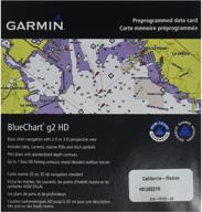
Realistic navigation features showing everything from shaded depth contours and coastlines to spot soundings, navaids, port plans, wrecks, obstructions, intertidal zones, restricted areas, IALA symbols and more. Smooth display presentation including seamless transitioning between zoom levels and more continuity across chart boundaries. Safety shading…
Read more about this product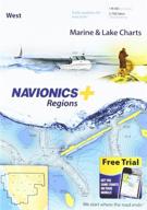

6 Review
Max detailed charts for cruising, fishing and sailing. Get full marine coverage and Canadian waters of Puget Sound plus more than 2,600 lakes in AZ, CA, CO, ID, MT, ND, NV, OR, SD, UT, WA and WY. Includes SonarChartTM 1 foot HD bathymetry map that reflects ever changing conditions, and Community Edits, valuable local information added by millions of…
Read more about this product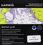

5 Review
Realistic navigation features showing everything from shaded depth contours and coastlines to spot soundings, navaids, port plans, wrecks, obstructions, intertidal zones, restricted areas, IALA symbols and more. Smooth display presentation including seamless transitioning between zoom levels and more continuity across chart boundaries. Safety shading…
Read more about this product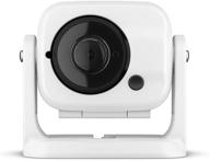

5 Review
Compact marine camera helps you monitor areas inside and around your boat. Wirelessly connect to your compatible chart plotter for high-quality images shown right on your display. Video is available for viewing on any other chart plotter on same network. Effective in total darkness; perfect for the engine room. Easy to install and hardwired for power…
Read more about this product
5 Review
Protects stereo from the sun and harsh Marine environment. Easy to install. Made from durable silicone. Boating-Radios.
5 Review
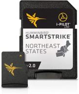
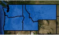
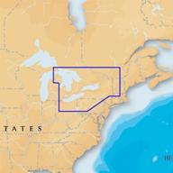
States covered: northeast States. Depth highlight range. Shallow water highlight.
3 Review
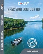
North Carolina Micro SD Card. 16 GB Micro SD Card. Survey quality Contour Data: 1-foot contour coverage, visible even at wide zoom levels. Custom depth shading; Choose colors for specific depth ranges to highlight fishing-holding depths and or hazard zones. Points of Interest: Traditional navigation information, C-MAP Navigation data, Fishing HotSpots…
Read more about this product
3 Review
Imagine finding a hot spot and in seconds your computer identifies all other areas of the Lake with similar characteristics. Just enter a species, time of year, and time of Day and your computer searches the entire Lake and gives you exact Coordinates. Navigate right to these areas using your GPS or even a laptop computer right on the water. Contour…
Read more about this product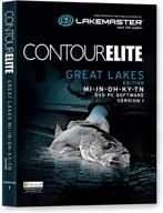
3 Review
Great Lakes. Accuracy and detail gives you a serious edge. Easy-to-read contours, depth highlight range, scrollable lake lists. 3D Viewer to rotate around a structure to see all the angles and features under the lake's surface. Search results for specific species based on season, weather and water conditions. Features 321 High-definition Lake Maps…
Read more about this product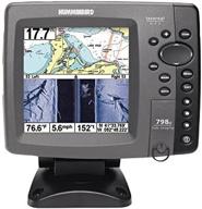
3 Review
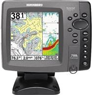
Chartplotter/fishfinder with high-resolution, 5-inch, LED-backlit color display, DualBeam sonar with 4000 Watts PTP power output. Dual-beam Switchfire Sonar with precision 20-degree beam and wider 60-degree beam; view beams separately, side-by-side, or blended together. Side Imaging Sonar delivers amazingly clear, picture-like images of fish, bottom…
Read more about this product

3 Review
Trackplotting and Chartplotting. 640 Vertical Pixels. Dual beam sonar. 1,000 ft depth capability. Tilt and Swivel Quick Disconnect Mount.
3 Review
Topographic maps for Northwestern US. For use in HDS GEN2 Touch, HDS GEN2, Mark HDI, Elite HDI, Mark And Elite. Satellite imagery with resolution down to 8m. Package weight: 1.0 lbs.

3 Review
Paper chart appearance for the Clearest charts and best detail. High-resolution satellite photo overlay. 3-Dimensional view. Panoramic port pictures. On SD/micro-SD card.

2 Review
640 vertical pixels. 256 color TFT screen. DualBeam PLUS sonar. 1,500 ft depth capability. Tilt and Swivel Quick Disconnect Mount.
2 Review
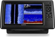
Clearer scanning sonar - shows you more of what is in the water around your boat. This high-frequency sonar gives near-photographic images with detailed representations of objects, structure and fish. Chirp sonar - Chirp sends a continuous sweep of frequencies which provides a wider range of information. Chirp sonar is able to create crisper fish arches…
Read more about this product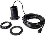
2 Review
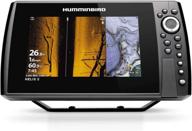
8" widescreen display. Features MEGA Side Imaging+, MEGA Down Imaging+, Dual Spectrum CHIRP Sonar, internal GPS with Humminbird Basemap, AutoChart Live, Wi-Fi, NMEA 2000, Bluetooth and Ethernet networking. MEGA Side Imaging+: See the world below like never before with a crystal-clear Side Imaging viewing out to 200 feet on either side of your boat…
Read more about this product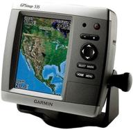
1 Review
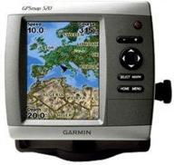
GPSmap 535. Ultra-Bright 5-Inch Diagonal Full Vga Display. 640 X 480 Pixels.