
Review on DroneMapper RAPID by Kev Mills

Very user friendly product - Easy learning curve
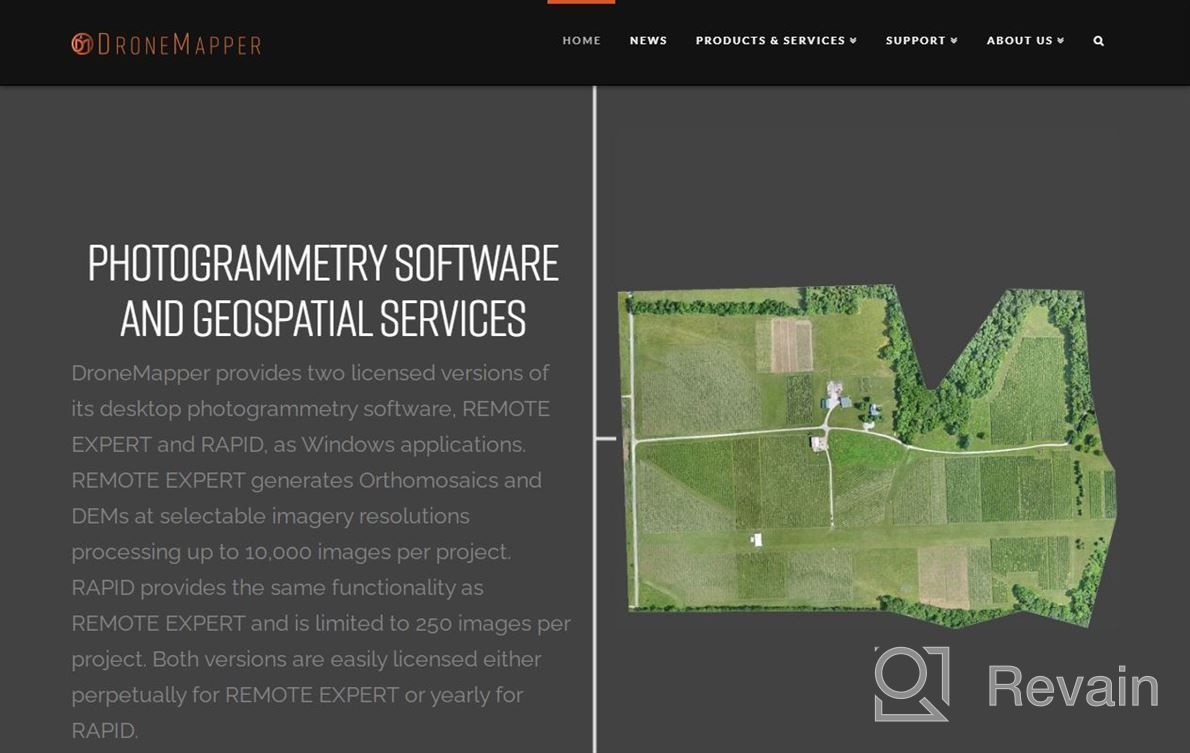
It has been very easy to learn, it runs great in Win 10 with no issues at all for my needs right now. You can run this software anywhere you have access to internet or an Ethernet port so your not tied down by having expensive hardware that only works inside of their office environment. I wish there were more control over where I could see maps being saved like from Google Drive instead of just local drive. Maybe someday they will expand its ability but as far as what i've seen thus far, its pretty limited in terms of functionality/accessibility compared to other products out there including ArcGis Pro which also does most everything mentioned here plus wayyyy more! The benefits are ease of use and cost effectiveness when comparing prices vs features provided versus time taken to get up & running. Also helps me keep track of data collection locations over several years since first started collecting aerial images using drones about 5+.
- Its simple user interface is intuitive enough even if unfamiliar wth any mapping applications before hand (like myself) while still providing good quality results without much effort required after initial setup takes less than 30 mins max depending upon how many points need collected
- Great price point too especially considering full version costs nearly double amount shown above per month
- It is hard to say


